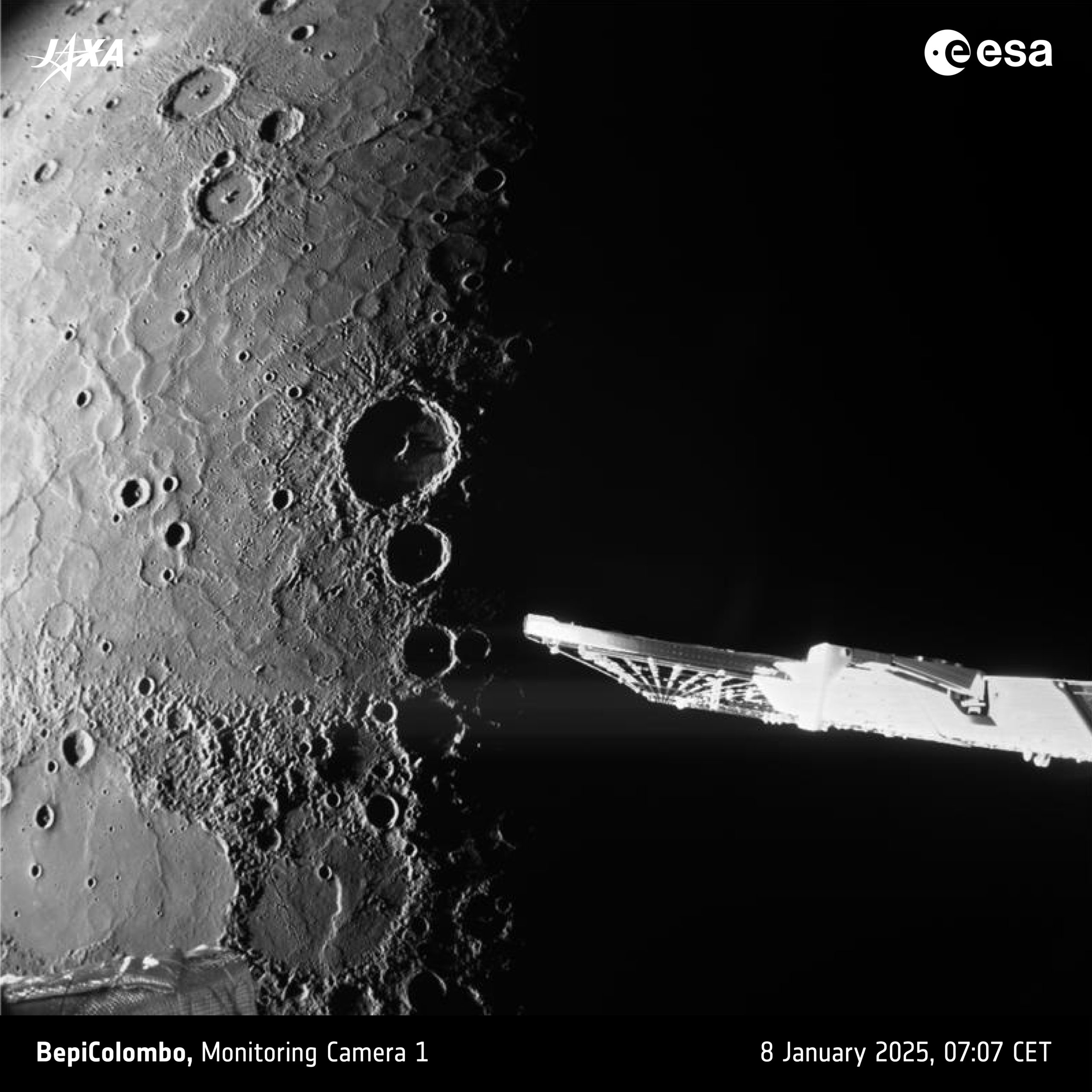
M-CAM 1 took this long-exposure photograph of Mercury’s north pole at 07:07 CET, when the spacecraft was about 787 km from the planet’s surface. The spacecraft’s closest approach of 295 km took place on the planet’s night side at 06:59 CET.
The second image is annotated.
Text and credits: ESA
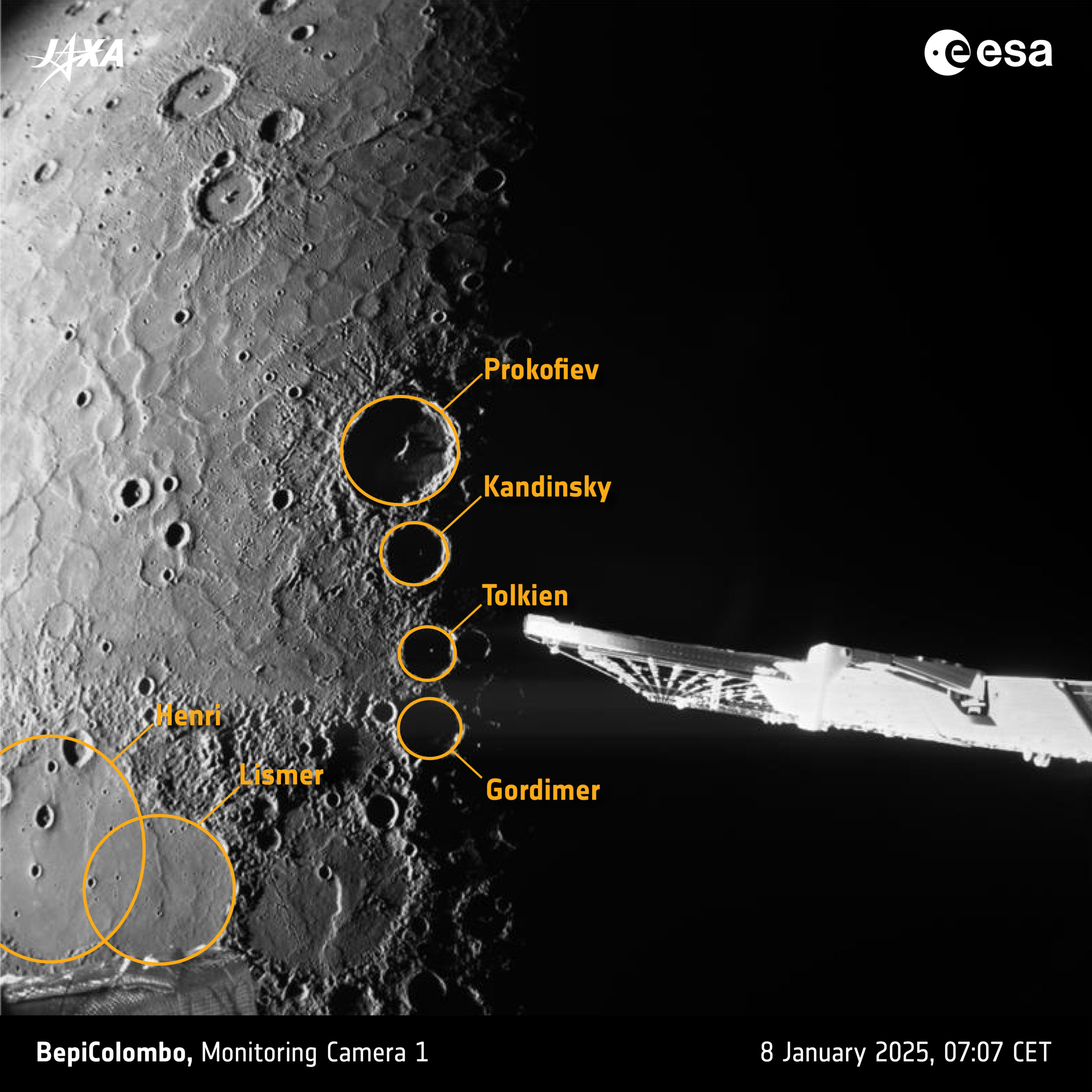
In this view, Mercury’s terminator, the boundary between day and night, divides the planet in two. Along the terminator, just to the left of the solar array, the sunlit rims of craters Prokofiev, Kandinsky, Tolkien and Gordimer can be seen, including some of their central peaks.
Because Mercury’s spin axis is almost exactly perpendicular to the planet’s movement around the Sun, the rims of these craters cast permanent shadows on their floors. This makes these unlit craters some of the coldest places in the Solar System, despite Mercury being the closest planet to the Sun!
Excitingly, there is already evidence that these dark craters contain frozen water. Whether there is really water on Mercury is one of the key mysteries that BepiColombo will investigate once it’s in orbit around the planet.
The left of the image shows the vast volcanic plains known as Borealis Planitia. These are Mercury’s largest expanse of ‘smooth plains’ and were formed by the widespread eruption of runny lava 3.7 billion years ago.
This lava flooded existing craters, as is clearly visible in the lower left Henri and Lismer craters. The ‘wrinkles’ seen in the centre-left were formed over billions of years following the solidification of the lava, probably in response to global contraction as Mercury’s interior cooled down.
The volume of lava making up Borealis Planitia is similar in scale to mass extinction-level volcanic events recorded in Earth’s history, notably the mass extinction event at the end of the Permian period 252 million years ago.
The foreground of the image shows BepiColombo’s solar array (centre right), and a part of the Mercury Transfer Module (lower left).
Text and credits: ESA